
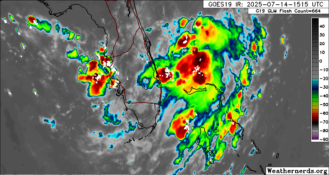
Miami, FL – The National Hurricane Center released an update at 8:00 AM EDT today regarding an area of low pressure located offshore the east coast of Florida. The disturbance is producing disorganized showers and thunderstorms and is forecast to move westward across Florida within the next 24 hours, reaching the northeastern Gulf of Mexico by late Tuesday, July 15, 2025.
The NHC estimates a 30% chance of gradual development into a tropical cyclone as the system moves westward to west-northwestward across the northeastern and north-central Gulf through the middle to latter part of this week.
The NHC report indicates that environmental conditions, including water temperatures above 90°F in the Gulf of Mexico, may support this potential development, consistent with a 2023 NOAA study linking ocean heat to cyclone intensification.
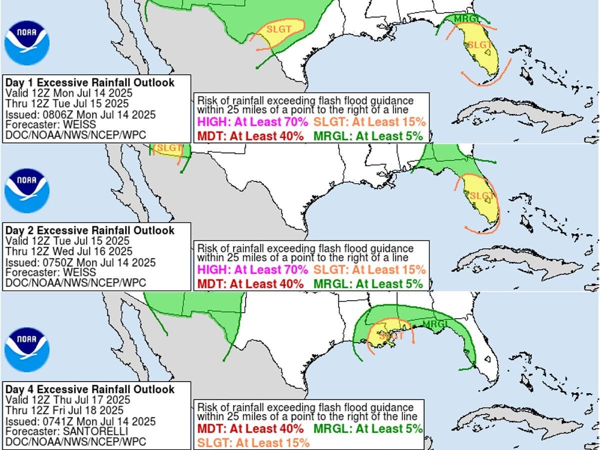
Regardless of whether the system develops, heavy rainfall is expected to produce localized flash flooding across portions of Florida and the north-central Gulf coast through Friday, July 18, 2025. Residents are advised to monitor updates at https://www.nhc.noaa.gov and local forecasts at https://www.weather.gov for detailed information.

The system’s east-to-west trajectory across Florida deviates from typical Gulf storm paths, a pattern potentially influenced by an atypical atmospheric vorticity, as noted in a 2022 Journal of Geophysical Research paper on cyclone tracks. Additional updates will be provided as the situation evolves.