Source: National Hurricane Center
Tuesday, July 15, 2025 – Invest 93L will bring showers and thunderstorms to our region today. The National Weather Service Tampa Bay office forecasts showers and thunderstorms across the area, primarily in the afternoon and evening, with locally heavy rainfall and potential flooding in urban, low-lying, and poorly drained areas. Gusty winds are also possible. The severe weather risk is classified as a Marginal Risk (Level 1 of 5) for the Florida Peninsula during the peak of the Atlantic hurricane season.
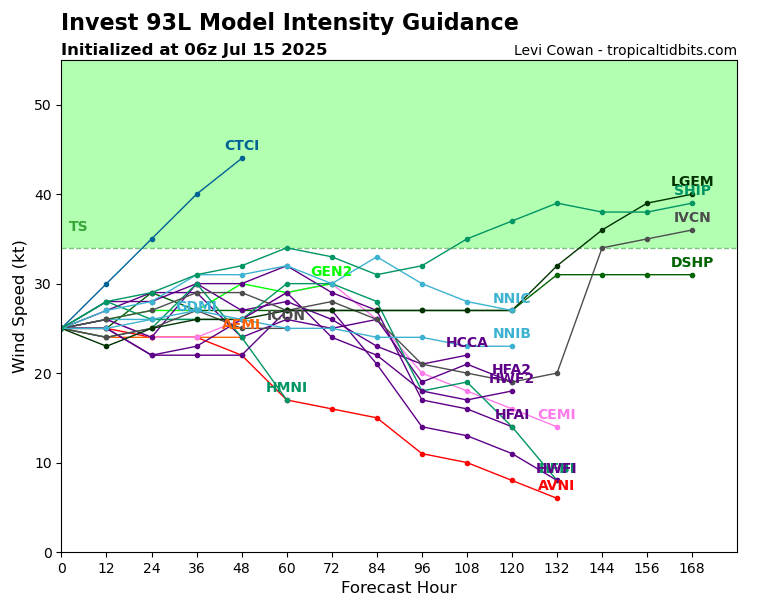
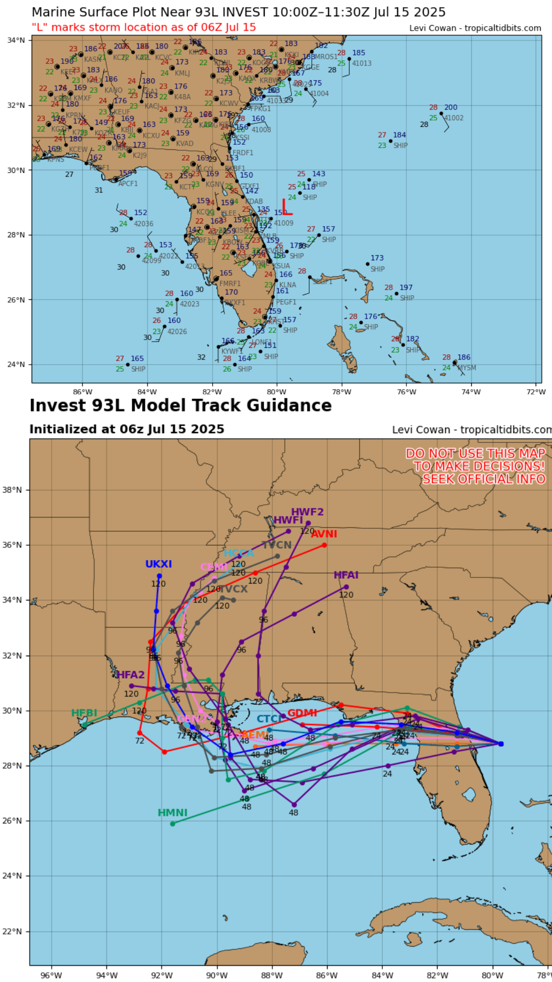
The National Hurricane Center has increased the development chances for Invest 93L, an area of low pressure off Florida’s east coast, to a 30% chance over the next two days and a 40% chance over seven days as it moves westward into the northeastern Gulf of Mexico. The system could potentially develop into a tropical depression later this week, fueled by favorable conditions such as warm Gulf waters. Residents along the north-central Gulf Coast, including Alabama and Louisiana, are urged to monitor updates, as heavy rain is expected regardless of tropical cyclone formation.